Saturday, July 30, 2005

Too Late

Greg H called and said that the weather was just right for the launch at Cannon Mountain. Dave, Greg C, and Mark also thought Cannon was the right choice for the day. Who am I to argue? We stopped at Ascutney to pickup Greg H's van that he left there before flying yesterday. On the drive to Greg's place on the way to Cannon, we noticed that the wind was NW, not the NNE required at Cannon. After some discussion at Greg's, we decided to drive all the way back to Ascutney.

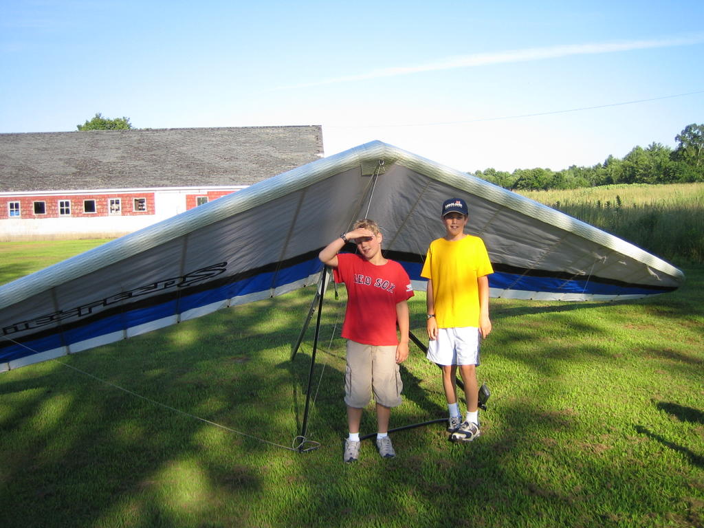
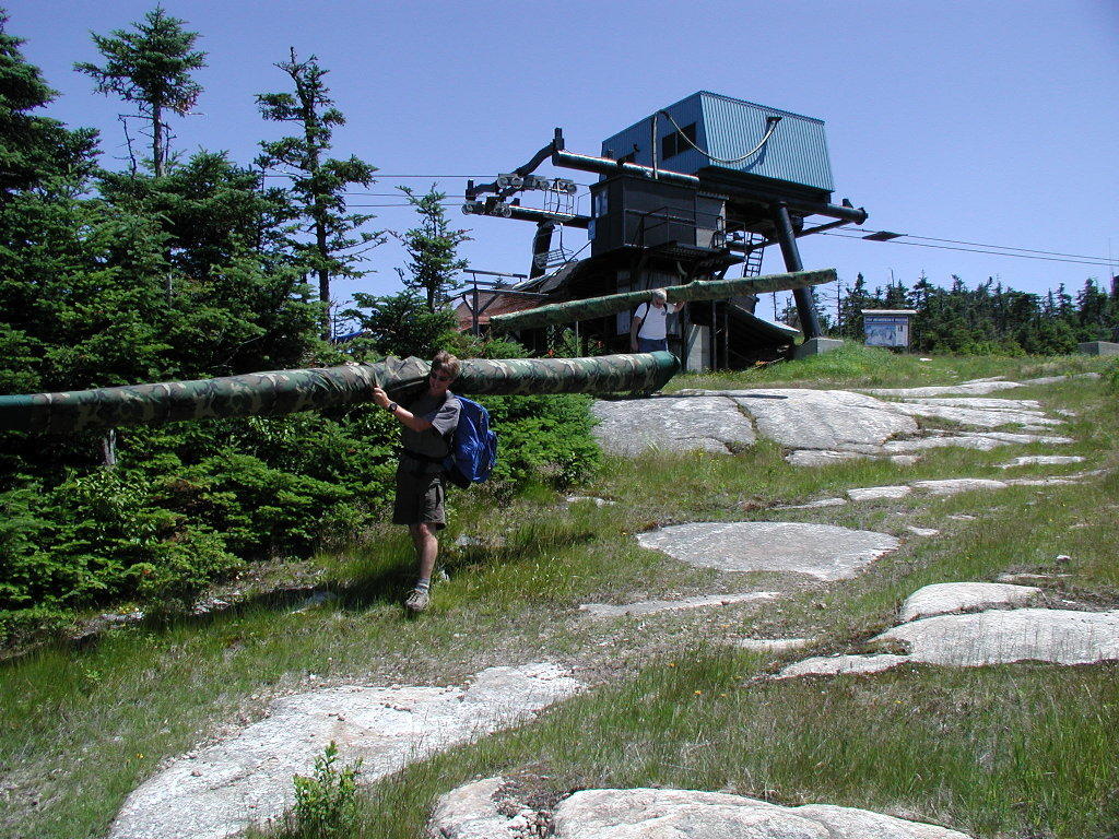
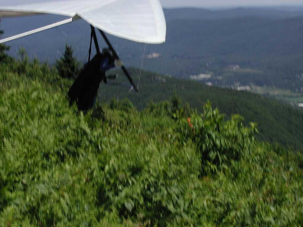
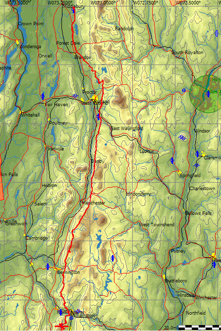
Jeff and Jake were already setup when we hiked into the launch. The clouds looked good and there was some wind blowing into launch at times. After throwing our gliders together we collectively tried to figure out what was happening with the weather. Obviously the NWS forecast was wrong. The clouds were starting to show signs of building into large "complexes" that might produce rain. I wanted to get off launch so I offered to go first. For some still unknown reason my radio wasn't working. Meanwhile Jake launched and basically sledded to the LZ. Ouch. I wanted to launch right after him to help out, but the tailwind at launch keep me on the ground. Once the tailwind stopped I launched and found some bumps to the left of launch. I kept searching thinking it might be coming up the southwest bowl. Ooops, not there. Instead I got crushed and was soon headed to the LZ with Jake. I found a few pops at the base of the mountain and hung on. I eventually managed to start climbing and drifted to the south. I was about launch height when Jeff and Dave launched. I flew back to the mountain and joined Dave in a rough climb over the ski area. By this time Jeff was floating among the clouds over us. I gave a quick call to Mark to join us, but he had his radio off. The climb to cloudbase was rough so I was ready to leave when I got within 500 feet of Dave and Jeff at the top. We decided to head towards Green Mountain. For some reason Jeff started heading NE instead of SE towards Green. Dave and I maintained our spread by fading north to cover Jeff. Instead of heading towards the nice clouds over Green we were flying into the blue. What the ....? Finally I turned towards Green but not before losing most of our altitude. I found a broken climb that Dave found but Jeff missed. We watched Jeff land as we climbed high enough to continue on towards Green. Meanwhile, the clouds over Green were drying out. Dang, we missed it. We heard that Dan, Greg C, Greg H, and Mark were now leaving the mountain.

I found a good climb in the blue over Green, climbed a couple thousand feet, and then raced off to the still receding clouds. I connected with a good climb at the edge of the clouds. Dave was too low to push on, so I waited for him to get high enough to keep together. I noticed the clouds were continuing to recede and decided to push on towards Newport. I had a sweet glide, gaining 100 fpm along the way. I waited a few minutes and then Dave and I headed towards Newport and the quickly decaying clouds. We checked out a few dying clouds but eventually made our way to the forbidden fields since we didn't have enough to get over Mount Sunapee. I radioed my fate to Kristi, tried to find a flight-saving low climb, and then landed along the road.

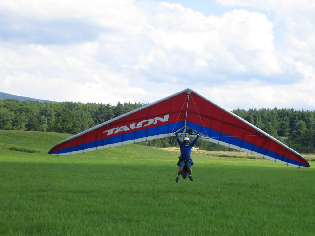
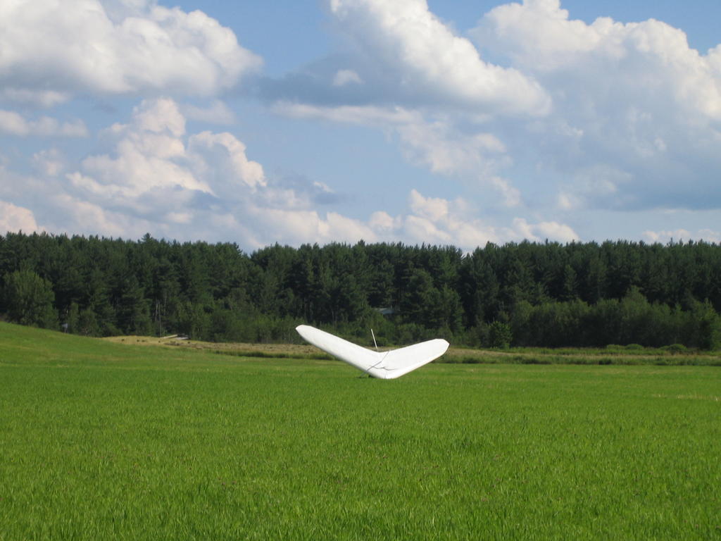
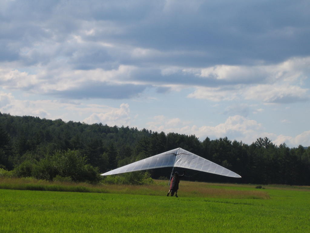
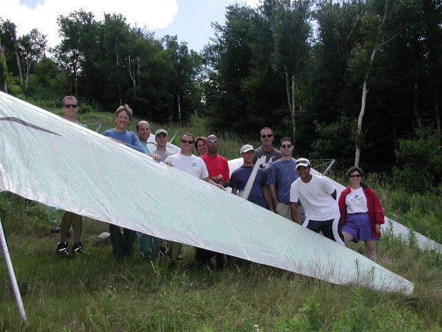
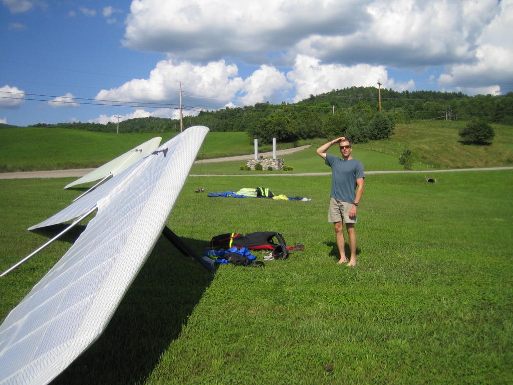
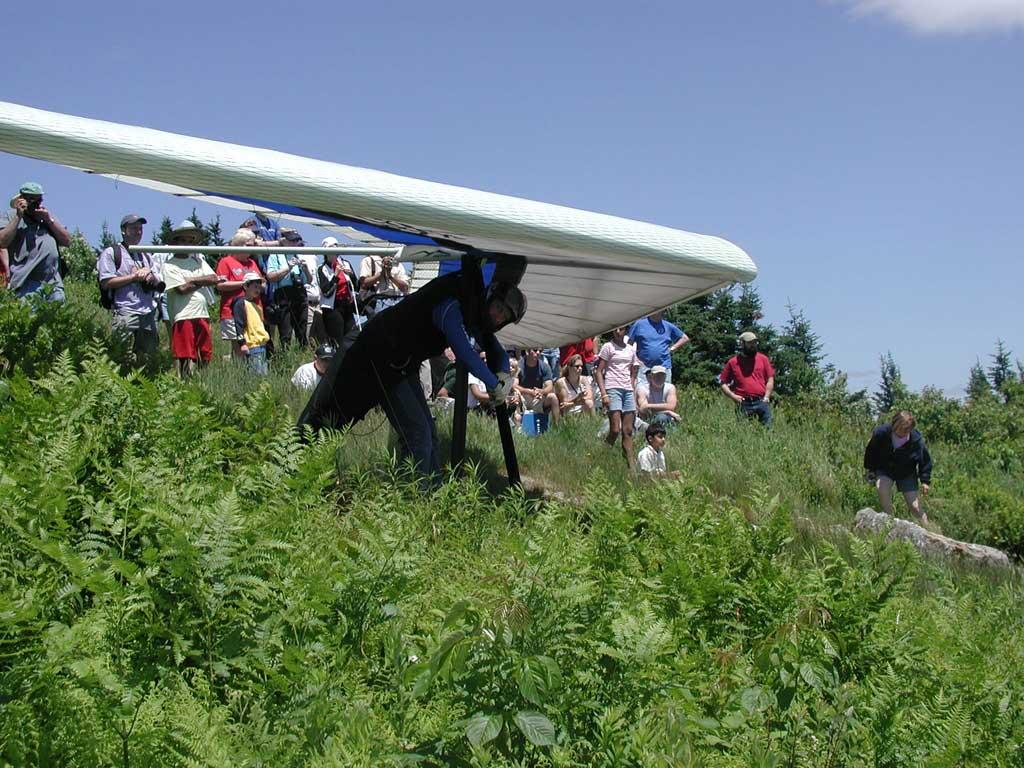
I managed to turn around and watch Dave land. A few minutes later the rest of the gang floated in. We radioed the current conditions and that a thermal might be breaking off. They did find a climb and we thought the might get away. However after a few minutes they all came back to land with us. I got many pictures of each pilot's landing. It paid to get there early.

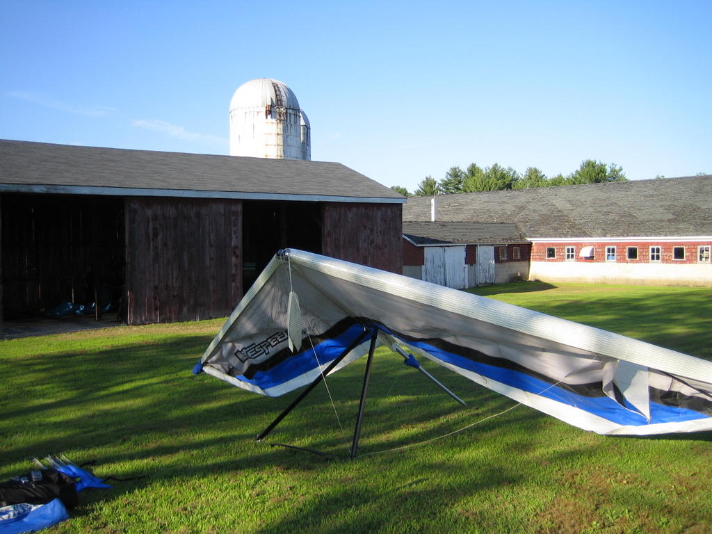
We broke down, got our vehicles, and still had time to get picnic food for the "movie" night party at Camp Rob before going to the VHGA meeting at Morningside.

Friday, July 29, 2005

Repair Day

I faced a tough decision today. Go fly at Ascutney on a promising XC day or spend some time at Morningside fixing things on my glider. I decided to go to Morningside. I quickly found out that Chris AND Marilyn were both available so I wasted no time removing the sail from my glider. Marilyn repaired a seam across the right tip that was coming undone and patched a tiny rip on the top surface. Meanwhile I took off my right leading edge that had a tiny dimple I got on a ride up the 4WD road to West Rutland a couple months ago. I was glad that Chris was drilling and popping the rivets off the old leading edge and also setting the new rivets on the new leading edge. What he did in an hour would have taken me all day and several trips to the hardware store for new tools. Within an hour were done and I was reinstalling the sail.

Once I had the sail installed I made the mistake of looking outside. The previously blue sky was now filled with cummies. Somehow I didn’t feel so bad missing the flying when inside the hanger! I headed into town to get a late lunch when I heard Greg, Jeff, and Mark on the radio. Mark had already landed, but Greg was at 6500 feet floating over Lake Sunapee. I wished them luck, made sure they had drivers, and then hurried back to Morningside so I could at least get a late afternoon flight.

I quickly set up my glider and waited for a ride to the “450” launch to make sure everything still worked. John Z launched but slowly sank out. I helped another pilot launch and then ran off for a few passes along the ridge before heading across the street to aero tow. Rhett was giving “tall tows” today, but I got off in some light lift at the usual 2500 feet. I played around awhile over the valley and on the ridge behind Morningside for about an hour before landing back at the runway. After helping several other pilots launch, I followed Rhett up and across the river into some light “end-of-the-soaring-day” lift. I climbed to cloud base and then decided put my glider through some tests to see if it still behaved when flown very fast. I did some 85 mph runs across the valley in smooth air and everything was “right on the money”. I buzzed over the hill at Morningside and then landed back at the runway

I later heard that Greg flew 78 miles and Jeff landed about 15 miles short of Greg. I missed the XC flying, but it is good to know that my glider is once again in top shape and ready to race in Big Spring.

Sunday, July 24, 2005

Floating Across the Countryside

I wasn’t sure I wanted to drive another 5 hours to go flying at Ascutney after driving all over New England so I could fly at Burke Mountain yesterday. However, the forecast looked good and it’s hard for me to turn down a good day. I assumed it would soarable for most of the day, so my goal was to stay in the air as long as I could. I needed a good flying workout in preparation for the upcoming competition in Big Spring TX so I wasn’t going to race or push too hard … I wanted airtime today.

John and Toni gave me a ride to the top of the mountain. After setting up, I spent some time giving Jeff pointers on his shiny new Litespeed and helping Jake determine how to fix his broken VG cord. I launched early and quickly found a climb. Since I wasn’t going to race off downwind today, I started flying upwind while I waited for everyone else to launch and climb out. I was a couple thermals upwind when it sounded like a good group of pilots were climbing at the mountain and making XC plans. I turned around and raced back to join them. It was nice to see so many local pilots climbing together. After most of the pilots topped out, we headed SE towards Claremont. Greg H and I worked a weak climb as I tried to figure out the drift and where the best lift was forming. Meanwhile Dan, Dave in his Litespeed, and Greg C climbed to our height.

Since there were only a few clouds downwind and the climbs were slow, Jake and a few other pilots headed towards Morningside. Jake thought it would be better to repair his VG cord than to dribble a few miles downwind. The rest of us headed east stopping briefly in a couple measly climbs. By the time we got to Kellyville NH, Greg C, Dan, and Dave were getting low. Dave and Dan moved on towards the Newport golf course while Greg C turned around and landed at Kellyville. Greg and I had plenty of altitude to move on but decided to wait on Dan and Dave. Dave found a weak elusive thermal very low at the golf course and Dan soon joined him. Meanwhile I was a cloud base and decided to move on to Mount Sunapee. I was past Sunapee when I decided to turn around and fly back to Newport to join the rest of the gang. I arrive at Greg’s height and at about the same time Dan and Dave were finally climbing with some authority at the golf course. Moments later Greg spotted Jeff in a good climb upwind. Unfortunately, Dave headed upwind to Jeff’s climb and lost a lot of altitude in the process. We left Dave behind as Jeff soon joined us in a weak climb near NW of Mount Sunapee.

I lead out and found a good climb SE of the mountain. Dave was thinking about landing at the forbidden fields, but I convinced him to keep moving. I ensured him that if he could come over Sunapee with 1000 feet he could easily make some nice LZs on the other side. I got cold floating around at cloud base so I moved on to another climb near Bradford. Since Dan, Jeff, and Greg didn’t leave the mountain, I flew back to join them and immediately left once it was clear there were not climbing. This time they followed me to a good climb at Bradford. Again I topped out and flew to another cloud SE of Bradford. Around this time Dave flew over Sunapee and headed to Bradford. He was much more comfortable now that he saw the fields I told him about earlier. Once the group (without Dave) was ready to go, we headed into the blue. We had a long glide towards Henniker. I lead with Jeff and Dan fading more to the north and Greg to the west. Greg stopped for a weak climb while I pressed on. Jeff and Dan were not doing as well and were losing relative to Greg and me. I finally found a weak climb downwind of some quarries and settled in for a long climb. Dave was now starting his glide towards Henniker, Jeff was somewhere low approaching Henniker and Dan and Greg joined me in my measly climb. Dave eventually landed at the airfield at Henniker and reported seeing Jeff in the area.

Then Greg, Dan, and I waffled around for a long time before taking another long glide towards the river near Concord. Greg and I were higher, but Dan finally found a weak climb that I went back for. I couldn’t find it and was soon down to his level. I pushed on towards better landing fields just as I spotted Jeff coming in to join us. Jeff found a nice climb just west of the river that made it easy for us to cross to the other side. Once across the river Greg and I surveyed the trees downwind while Jeff and Dan struggled to find a climb. Greg assured me there were LZs “out there”, but I wasn’t convinced! As we slowly drifted down wind I finally saw a couple fields that would “do in a pinch”.

Greg and I headed out with Dan still low near the river and Jeff following us low. I found a nice climb that Greg, just 300 feet below me, couldn’t find. I climbed to around 5000 feet and essentially went on final glide. I was stopping and turning in anything, but the day was dying. I heard that Greg had found a climb and was also gliding through “very smooth air”. I circled around my LZ in Fremont NH looking for any sign of lift. I did find a few bumps that let me hang out at 900 feet for 10 minutes before I floated into a large un-mowed hayfield full of milkweed plants. I made sure I had a good flare since there was no wind and very high weeds below.

After a hot hike out, I was greeted by a family that stopped to watch me land. I answered the usual flurry of questions and then started breaking down. A few minutes later another couple pulled off the road to talk. They had watched me circling overhead while picking blueberries in the blueberry patch I was maintaining over.

Dave, Julie, Dan, Greg C, and Christy showed up to give me a ride back. Dan had managed another climb at the river before landing. Greg was waiting in a large field near the prison a few miles NE of me. We all stopped for Japanese food in Concord before heading back to the mountain. Dan and I then kept each other awake as we then drove south towards home … right over the roads we flew over and then drove back to the mountain on. Um, maybe there is a smarter way to do this!

Saturday, July 23, 2005

Burke Mountain

The only thing that keep me sane this week was the consistently good looking forecast for today. Northwest at 10mph meant a fine weekend day at Mount Ascutney. Amy, back from Scandinavia, wanted to come along, hang around launch, socialize, do some reading, and even pick me up. Yep, things were looking good. However, a quick check of the weather this morning showed that the winds were forecasted to increase throughout the day. The direction was still NW, so Ascutney was still the place to launch and with the increasing wind it might be a day to fly to the ocean.

Greg called just as I was leaving home and said the clouds at his place in New Hampshire were already zooming by from the NE. Uh? NE? Greg was starting a campaign for Burke Mountain. Burke has a north facing launch and is located at a good place to start an epic XC flight to the south along the Connecticut River valley. The problem with Burke is its landing areas, or more precisely, the lack of landing areas. The choices are a down hill sloping field on the the mountain or a soccer field surround by trees on two sides, and a drop-off on the other sides. Burke is also another 2.5 hour drive beyond the 2 hour drive we were already planning to make to Mount Ascutney. However, Ascutney is no fun in a strong NE wind, so it was either towing at Morningside or a day of driving to Burke.

We caught up with Rodger at the Route 5 interchange with interstate 93. Rodger's first words were "I hate this sport!". Once Amy stopped laughing we discussed our options. Rodger was not interested in adding another 2.5 hours to his long drive. We decided to head north on the highway to get a better view of the early clouds from some high terrain. Yep, it was NE alright. Amy and I decided to give Burke a shot. If the day was blown out, at least we could stop and do some hiking at Fraconia Notch on the way home. Rodger was not interested and got off the highway at Springfield VT heading to Morningside. Meanwhile, Dave C, Greg C, Gary, Jeremy, Dave V, Greg H, and Dan were meeting at Greg H's place before heading north. Amy and I arrived at the general store at the base of the mountain just minutes before the rest of the gang arrived.

It was blowing in nicely when we arrived at launch so we all scrambled back up the ski slope to get our gliders. The clouds looked nice as the clouds quickly drifted by, but I didn't notice any birds soaring. About the time I finished rigging the glider, the wind started increasing and crossing from the left of launch. Soon the wind was 90 degrees plus to our launch run. At least the grass and weeds were tall, the wind was gusty, the tree line was close to our left, and the ski lift close to our right. We posed for Julie as she took group picture and then started contemplating our next move. No one wanted to land out front in these conditions. In fact most of the pilots didn't want to launch in these conditions either!

Finally, I spotted a hawk beaming up in front of us. It was climbing too fast for me to even make an educated guess at its rate. Dave C thought maybe 1500 fpm. That was enough be me; time to launch. I suited up, but was trapped behind Greg and Dan. Dan decided to launch first. He waited a long time before launching and still got tossed around and thrown towards a particularly nasty looking tree. I think several pilots decided not to fly at that point. I moved into position right after Dan launched but also had to wait for something reasonable to launch into. I got out of the slot straight and level but hit a wall of rising air as I cleared the trees. I floated up in the strong wind blowing over the mountain while Greg launched. The three of us managed to find a broken climb to cloudbase as we quickly drifted behind the mountain into the great northern forest at 21 mph. I radioed to Dan and Greg that we should leave immediately when the lift drops or we might not back it back out front. About that time Dave V launched and started soaring the mountain far below. The wind was now blowing from the NW, not the NE. Dang, the original forecast was right but just a late. It would be hard flying down the river valley since we would have to cross the cloud streets all the way south. We also couldn't fly downwind since there was nothing but mountains, rocks, and trees in that direction.

We should have flown directly upwind, taken another climb, and then cut across the blue part of the street at a 90 degree angle. However, the cloud immediately upwind of us was dying and the LZs in that direction were ugly anyway. So Dan led the way as we made a long 40 degree cut across the blue part of the street. As you might expect, we didn't find much lift and were soon picking out LZs in the strong wind. Since I did more exploring than the others, I was the lowest when we arrived over a reasonable landing area. It was obviously windy but so far the air had been mellow. However, I could see the grass swirling and trees getting bashed about as I made a quick pass over the field. I am sure I would have seen a dust devil if the ground had been dry. I got tossed this way and that as I tried to keep the glider going where I wanted it to go. I finally got it on the ground but it was too gusty to even move. In the time it takes to slowly count to 5, the wind smoothed out and dropped to a pleasant 10 mph. I guess I was in the wrong place at the wrong time. Dan landed a few minutes later followed by Greg who managed a small climb before coming back to the field.

We moved our gliders over to a church yard and just stood looking at the sky. What a beautiful sky. What kind of a moron lands 6 miles from launch on a day that looks like this? Oh well, we flew and landed safely. Sue and Amy showed up just as we finished packing the gliders. Most of us later stopped at the Lyndon Freighthouse for ice cream. Dave V landed safely in a large field a couple miles from the mountain and everyone else broke down and hiked out. The flying wasn't spectacular, but the scenery and company was great. Oh, Amy and I did get to see waterfalls at the Basin on our evening hike along the Fraconia Notch.

Friday, July 15, 2005

Cannon Mountain

The forecast of light northeasterly winds and a nice high cloudbase made Cannon Mountain an easy choice. However since I didn't have my truck for the day I wasn't going anywhere unless I could convince someone else to go along and give me a ride. It didn't take much effort to talk Mark and Rodger into making the 2.5 hour drive north. (Thanks guys!)

We met Jake, Judy, Dave, Julie, and Pete K at the Franconia Airport, a grass airstrip to the north that serves as the preferred LZ before heading to the mountain. Greg and Jon pulled into the parking lot at the ski area just as we arrived. Dave D was already there to greet us. After signing waivers and registering for the day, we loaded our gliders into the tram for the scenic ride to the top. After unloading at the top, we hiked a short distance to a flower covered ski slope that is our launch.

Before I talk about the flights, I should point out that some pilots don't like the looong glide out to the airport. Maybe its the 6:1 glide or the absence of any "bail outs" along the way. The official LZ at the bottom of the mountain is a gravel parking lot surrounded by tall trees on the back side of a hill. Sounds lovely doesn't it! The other option, which is perfectly acceptable on light to moderate winds days, is a downwind-uphill landing on a ski slope covered in tall grass. Some pilots never fly here because the landing options are not within their comfort range. Other pilots fly here, but are uncomfortable until they gain some altitude. Check out Rodger's comments on the Vermont Hang Gliding forum for a more humorous description of his first experience here.

We set up our gliders among the buttercups and daisies, posed for Julie as she took a quick group shot, and we then commenced launching. Jake went first and headed to Mittersill, a smaller mountain that is on the way to the airport. I launched next into a good cycle, took a couple quick turns, and then continued along the descending ridgeline towards Mittersill and Jake. I was below the top of Mittersill by the time I arrived there and was beginning to think I might be on a sled ride to the airfield. I couldn't see Jake, but assumed he was around the corner to the northwest. I finally found a shifty little 100 fpm climb that slowly took me over the top of Mittersill. I saw Jake below me to the northwest with a lot of trees between him and the LZ. In fact, there were a lot of trees between me and the LZ! I got on the radio and assured the other pilots on launch that there was lift out here. As I climbed through 4000 feet the lift increased to 500 fpm. Yahoo, cloudbase here I come!

The remaining pilots started launching and also got below Mittersill before getting a good climb established. Meanwhile, I was drifting southwest of Cannon Mountain and enjoying the spectacular views of Francia Notch, Mount Lafayette, and the endless carpet of trees. I headed southwest to another good cloud before realizing that the only way I was going to leave the valley was by heading north and then west. I "probably" had a good glide to some fields to the southwest in the Connecticut river valley, but it just wasn't worth the risk. So I started working to the north and then to the north west without much trouble. I was at the edge of the cloud field to the northwest when the rest of the gang finally reached cloudbase back at the mountain.

I could have waited for the group to catch up, but I decided to head into the uncertain blue by myself. I had a long glide over the trees and was low enough to be picking out LZs when I finally found a very weak climb. It was just strong enough to keep me within reach of fields as I drifted back into the trees. I kept looking for other signs of lift, but since I didn't see any I didn't dare leave the pathetic climb I was in. I was getting bored going nowhere, so got on the radio to let everyone know that I was low and struggling to stay in the air. The little climb I was in finally dissipated and I moved on. I spotted Dean Memorial Airport to the southwest and started gliding in that general direction. I came across a few weak climbs that would give me a couple hundred feet, but would soon fizzle out. I spent about 20 minutes working light climbs around the airport hoping to find the ride to cloudbase that would put me back on course. However, I finally gave up and arrived at the airport with a no-step landing that drew compliments from several pilots.

I was greeted by a co-worker of Greg's that was excited to see a hang glider up close. After I found a shady spot, I gave him and another pilot a quick walkthrough of my equipment. Greg's friend had flown a Cessna in from Lebanon New Hampshire. I let him know that Greg was heading in this general direction and that Greg's glider had the same colors as mine. Greg later told me that his friend did find him in the air and made visual contact. I talked to several pilots who were interested in my unusual (for them) aircraft. The airfield itself was nice. I resisted the temptation to pick the raspberries growing in the garden along the taxiway. The garden and environment around the runway made it seem like I was landing at someone's home.

Dave C, Greg, and Mark made it to the airport with plenty of altitude shortly after I landed. Dave was having problems with his harness so he decided to land there. Dave and I then broke down our gliders while listening to Mark and Greg as they continued down the river valley. Both would be silent when gliding. Then we would hear the vario chirping away in the background and one of them shout "I have one!". Then they would be quite again until it was time to decide where to go next. After some discussion one would say "I'm leaving" and the cycle would start anew.

Dave D headed upwind to land on or near some family property. Everyone else landed at the airport. Julie and Peter drove back in Peter's truck to pick up Dave and Rodger drove Mark's truck to pick me up. Greg landed in a field next to his home. Mark landed a few miles further south for about 38 miles. We had a tough time finding Mark since he was out of radio range and we didn't have good cell phone coverage. I talked to Mark just long enough to find out he was on "Hogback Road". I didn't get what state or town he was in or his GPS coordinates! Sigh. We just kept driving south and eventually made contact with Greg who relayed messages to us until we were close enough to make direct contact.

Jon, Dave C, Julie, Rodger, Mark, and I stopped for Tai food in Hanover. Greg also stopped in for a brief chat. We all agreed that next time we are at least flying to Morningside.

Once again I want thank Julie for the awesome pictures!

Tuesday, July 12, 2005

Downwind is Upwind

Some days are just unusual and today was one of those days. It started when I picked up a hitch-hiker on the entrance ramp to the highway near home. We stowed his plastic-bag covered luggage in the back and hit the road. He was heading to Burlington VT from the cape. He was pleasant to talk with even if his hygiene wasn't. He gave me some tips on hitchhiking, we talked about various things including his experiences in the MIT soaring club before I dropped him off at Springfield VT, two hours closer to his destination.

Rhett was already towing pilots looking for smooth conditions when I arrived at Morningside. After the required socializing, Dave, Michael, Kirin, Peter K, and myself started setting up our gliders. It was soon obvious that the wind prediction was unfortunately accurate; southeast around 8 mph on the surface and northwest around 10 mph at 5000 feet. It was strange launching in the same direction the clouds were drifting! I knew it would be hard determining where thermals were feeding from and where they would form a cloud. The climbs were good (200-400 fpm) but broken by the shearing action of the wind shift. Still I climbed right to cloudbase after releasing.

I lost Dave while I was climbing so I eventually flew back to join Michael. Although Michael doesn't fly with a radio, we talked earlier about flying to Keene and back, trying to fly "downwind" both ways. Michael was much higher and took off towards Keene so I figured he was on his way. The climb fizzled early so I moved on. I found a climb down low just south of Morningside that was drifting to the south! As I climbed I started drifting back to the north and then back to the south again. Funky. I reached cloudbase over Charlestown and was still looking for Michael. I finally saw him north of Morningside. What's he doing over there? (I later found out that he turned around much earlier when he failed to find anything interesting.) I did a nice long glide back to Morningside that started out with a head wind and then turned into a tailwind. I met up with Dave for a slow climb east of Morningside that only postponed our return to earth.

I grabbed some water, helped Kirin launch, and mounted up for another go. This time I found some weak and broken lift that turned into stronger and devil-inspired lift. I warned Dave, who was on tow, to stay away from the crap I was in. Dave found a nicer climb to the west of Morningside and I flew in far below him and still found it working. Once back at cloudbase Dave and I decided to fly to Ascutney and back. On the way there we both noticed the serious shading caused by the latest pulse of cloud development. We flew over the southeast corner of the mountain and then headed back. I basically had a dead-air glide under a mostly blue sky to the "red barn field" on Route 12A. As usual, something was lifting off has I cleared the treeline to my intended LZ. I setup for a crosswind landing, dove close to the tall trees on the north side and zoomed into the field. Dave setup a nice approach and came in minutes later.

Michael was nice enough to drive my truck over and Dan, who flew at Mount Ascutney, stopped by on his way home. Dave and I talked with the son-in-law of the land owner who rode up on a sharp looking motorcycle. He was coming over to help with the haying in the next field over. A short time later, Dave and I had to quickly move our gliders when the crew drove out with several loads of hay.

A while later, Dan, Dave, Julie, Michael, and I watched the clouds reform and drift north and south at the same time while we had dinner on the deck at the Indian Shutters restaurant. Although I only flew for a couple of hours and didn't go very far, it was still a fun and interesting day.

Sunday, July 03, 2005

Tour the Green Mountains of Vermont

I rolled over in the back of my truck at Morningside trying to shield my eyes from the sunrise so I could get a few more minutes of restless sleep. I wasn't in the best physical shape after spending the evening at Camp Rob and the remainder of the night tossing around unsuccessfully trying to get comfortable. However I knew I couldn't sleep much longer since the forecast was for southeast winds which meant an early launch at the east-facing launch on Mount Greylock. Oh, Mount Greylock was at least a 2.5 hour drive away.

Dave, Julie, Rodger, and I gathered in the parking lot at Morningside at 8am and we headed south. We took 3 separate vehicles since Rodger and I were most likely going to head home after our flights while Dave and Julie would head back to Morningside. Since Dave and Julie were not familiar with the drive or Mount Greylock, I played tour guide on the radio while we drove. I also noticed the familiar signs of a good day; an east wind at Greenfield and at the Mohawk Trail launch, cummies forming, and birds circling.

We pulled into the LZ about the same time that Pete showed up. Mark gave us a detailed update on the new landing procedures since the field is now a driving range for golfers. I threw my glider on Julie's truck and we headed up. Greylock is somewhat different from most of the other sites in New England since the general public has full access to the launch. As usual, I answered many questions from curious bystanders while I hastily set up. I helped Dave sign in, gulped down a sandwich from the cafe in the AMC lodge, and with Gary's help cleared the crowd and moved to launch a little bit before noon.

Its time for a confession. I have trouble keeping the nose of my glider down when I launch at Greylock. I got the basebar caught on a rock years ago and always want to keep the basebar away from the ground when I launch there. Although I try otherwise, I always seem to launch with the nose too high. The last thing I said to myself before launching was "nose down". I still let the nose come up on my run. Julie even got a picture to prove the point. My wings were level and I ran hard but I do need to polish my launch skills.

I launched in a good cycle, the crowd cheered the first launch, I turned right, found a thermal over the powerlines, started circling, and didn't stop until I reached cloudbase. I left that cloud for a newly forming cloud out front while Rodger, Dave, and Pete launched. I played around awhile and joined them back over the mountain as they climbed through 5000 feet. The four of us headed back out front. I headed northeast to Ragged Mountain since I saw several cummies form and dissipate there earlier. Dave headed my way while Pete and Rodger faded to the south. Dave and I found a nice climb while Pete and Rodger retreated back to Greylock for a refill.

Dave and I took another climb that we really didn't need over North Adams before heading to the high ground north of the airport and the gap. I wanted to get to the nice clouds that always form over the Green Mountains to the northwest. I also wanted to "cut the corner" by going directly over the high ground and get into the next valley. Since Dave's glider doesn't have the glide that my glider does, I wanted to stay high and not force either of us to dive off of course line into the gap or the valley beyond. We safely crossed the high ground when Dave charged off into some strong sink and then turned around and flew right back through it. Ouch. I decided to stay closer to the high ground, but made the same move. I was also "treated" to strong sink but was "rewarded" with a good climb on the other side. This put me a climb ahead of Dave. We were both comfortable with the situation and so I moved on. I told Dave that if we could just get to the clouds ahead we could "do some damage". After a couple of climbs we managed to catch the retreating clouds and found the stronger lift we expected.

The wind was from the southeast around 6 mph so we were flying on the lee side of the valley. Dave was staying at the of edge the valley while I was traveling along the peaks further east. Things were going great until I took a glide 90 degrees off course line further into the mountains for a climb I really didn't need. I missed the climb and then had to fly through the sink from the collapsing cloud. Crap. Now I was on the lee side of a mountain below its top sinking like a stone with another smaller mountain between me and my shrinking landing options. I was now stuck with the exit ramps on Route 7 as my "bail out". I radioed Dave to let him know that I was in an uncomfortable position. It rarely happens to me and I don't like it. I found a turbulent and trashy climb that finally turned into something useful once I got above the mountain upwind of me. Whew.

Meanwhile, Dave caught up and passed me by working the climbs over the valley. Dave flew over to Mount Equinox, a favorite flying site that was closed before I started flying. I decided to continue along the lee side since the clouds looked better ahead. Dave ended up landing in Manchester Vermont (38 miles) when he tried to cross back over the valley. The valley north of there gets narrow and the LZs are further apart. I was entering a field of clouds at the right time. I relayed messages for Dave, said farewell, and moved on.

Although there was cirrus moving in from the south, the climbs were getting better since it was only 3pm. The trip from Manchester to Rutland was classic cloudbase flying. I didn't race hard since I wanted to check out the new terrain below me. I saw a white marble quarry where they created a pillar island in the center that was at least 300 feet tall and covered in trees. I could easily see Mount Okemo and Mount Ascutney. I could have easily reached Mount Okemo and gave a passing thought to turning right and trying to land at Morningside. However, I choose to continue to the north and explore some more.

The day was drying up by the time I passed Rutland. The climbs were getting weaker and the wind shifted to the southwest. I also spent more time flying down out of the mountains since there were tree covered foothills instead of valley fields at the bases. I lost some precious time when I got low back in a valley and had to glide back along my course to stay close to a safe LZ. Dave and Julie called me on the radio and said they were approaching Rutland. I told them I would land close to Route 7 if possible. I connected with a few clouds that were forming over the valley and got back to a now lower cloudbase. I was treated to a gorgeous view of the sun shining on Lake Champlain with the Adirondacks to the northwest. I continued northwest into the blue and setting sun. The fields below me were either corn or unmowed hay. I picked a field that looked mowed, but had two sets of powerlines running through it. A local amateur radio operator stepped in and wanted to know if everything was ok. I said everything was fine and that I was just shopping for a nice landing field. He laughed, warned me about the mosquitoes, and wished me a good evening.

About that time I noticed an airfield to the north. I needed more altitude but the day was just about done. Dave and Julie were right below me as I try to gain altitude 5 and 10 feet at a time. After a lot of work I finally had enough altitude to glide into the Middlebury State Airport. Dave got on the Unicom radio and announced my arrival. What service! I landed next to the runway and then walked over to the shade of a couple large pine trees to break down. We had a pleasant conversation with the airport manager while I zipped up the glider. A quick check of the GPS showed we were 93.4 miles from Greylock.

I want to thank Greg, Dan, and Jon who saved me many hours of driving my truck back to Morningside. I want to thank Pete for some great pictures of the gang and the shot of me after launch. I can't thank Julie enough for chasing Dave and I across the state of Vermont, giving up a good day of flying, and taking such nice photos. Thanks Julie!

Several people have told me this might be a new record for Greylock. I hope others will try this course in the future as it is very scenic.

Saturday, July 02, 2005

All together now ...

The forecast was shocking. Today was the first of a three day weekend and the weather looked good for each day. I double checked the weather to ensure I was reading the forecast for New England. Yep, still looks good. A long-predicted cold front was beginning to wash out around the Massachusetts coast line but the National Weather Service was still promising cool dry weather to the north. It was still warm and humid when I left home for Ascutney. Once I was on the road, I gave Rodger a call. He said the sky was cloudy to the north of Keene. Uh? That wasn't supposed to be there. I talked a little later with Greg and he said the satellite picture showed clouds all across western New York and southern Canada. I guess I was being setup again by another forecast gone bad. Rodger decided to head to Morningside and "hang out", Greg decided to skip the day, and I went straight to Ascutney to hopefully join up with some other optimists. I arrived at the base at 11 but no one else was around. I thought about driving up, hiking out my gear, hiking back, driving down, and then riding up with the late comers. Nah, too much work. I tried to convince Rodger and Dave to quickly head over, but they weren't taking the bait. Finally Greg called and said he had changed his mind and would be at the mountain around noon. Like clockwork, about a dozen pilots showed up within 5 minutes of noon.

It was good seeing a large turnout at the mountain again. We also had a lot of hikers sharing the walk out and launch. I setup as quickly as possible and launched right after Jake. It wasn't too difficult to climb to cloudbase but I fell into the usual routine lately of "waiting to leave as a group". Flying as a group can be fun, but it can also severely limit the ground you can cover. The group can only progress at the speed of the slowest pilot. Also the group suffers every error of every pilot. For example, if a pilot misses a climb, the entire group is delayed by one climb. I prefer flying with people headed in a general direction knowing that we will sync up several times during the flight. However, the social pressure to "join in" is hard to resist.

We headed down wind towards Morningside bouncing under several nice clouds. However, it soon became apparent that the sky was quickly drying out. There was a nice line of clouds to the southeast, but that meant flying over restricted landing areas with a rising terrain. The entire gaggle, me included, hovered over Claremont trying to decide where to go. East and south looked very blue, southeast looked like a folded carpet of trees. The group finally decided to head down the river. Dave and I took off that way while the rest of the gang circled in very light lift. We made it to Charlestown before turning back. I had a nice line and turned back when I still had about 4800 feet. Why did I turn back? It wasn't the comfort of landing at Morningside. So it must have been to rejoin the group. I lost more altitude on the return trip and came in way below the gang just as they left. I then returned to Charlestown arriving there low. Duh. I knew better than to turn back. Group suck got me.

I ended up working some shifty lift coming off a farm tucked back in a shallow valley with Shawn before finally landing. I landed near a driveway and walked the glider to a shade tree. We were soon greeted by the landowner that was not pleased to see us. We quickly broke down and carried our equipment off the premises. We did however, buy 8 quarts of strawberries that we snacked on for the rest of the day. Julie picked us up and then Tim and Laura gave us a ride back to our vehicles at the mountain. The rest of the gang basically got one more climb and glide before settling down in the valley. I guess the cool dry air finally arrived. Too bad we didn't get started an hour or two earlier.

I decided at the end of the day to avoid my natural tendency to "hang with the group" just to be with the group. There are days when flying with a group is smart and fun if the group is moving at a reasonable pace and is not afraid to temporarily leave stragglers behind.