Once on launch at Mount Ascutney, I was surprised to see the wind was really more north than northwest. Even more surprising was the strength of the wind. Yeehaw, it was going to be a fun day standing on the rocky perch we call launch. I was the first to go. I asked Judy to standby on the keel wires since there was a lot of ramp suck when the gusts roared through. I cleared Lee, Marshall, and Judy, dove forward, and was immediately blown straight up for a classic Ascutney elevator launch. I probably gained a hundred feet in just a few seconds. It was easy to soar in the ridge lift and the occasional thermal blowing through. One-by-one pilots punched into the air and joined the gang floating around the top of the mountain. John and I repeatedly flew upwind looking for a climb, but always came back to the mountain to recharge our depleted altitude. I began to think we would be chained to the mountain when I noticed Jim circling low in front of the ski area. I flew across the mountain and merged in above him for a genuine thermal climb. Rodger and John soon joined in and we finally had our ticket out.
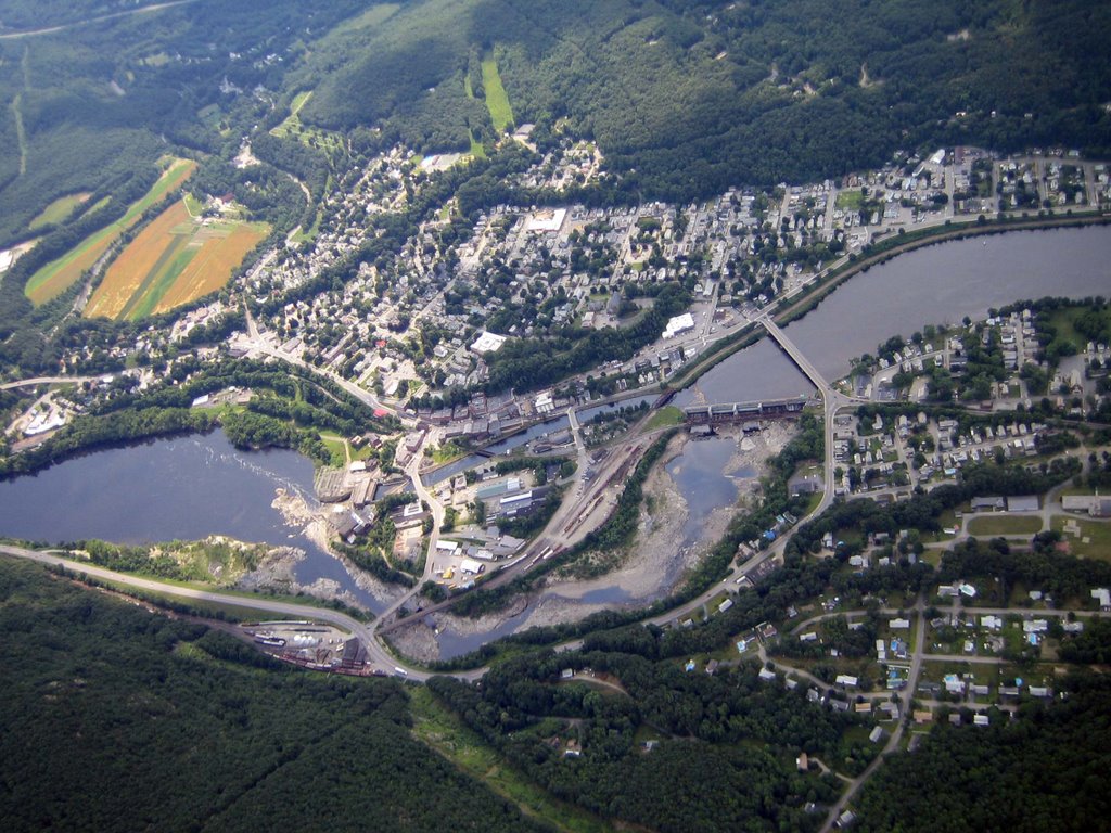 I left first and had a buoyant glide to a cloud to the southeast. I was already climbing at the next cloud before Rodger and Jim left. I didn’t want to get too far ahead so I started gliding back towards them to loose altitude and get back into the same air. Jim headed further east and didn’t do as well as Rodger and John. Rodger, John, and I were soon back at cloud base and continued south. John and I zigzagged back and forth as we cruised from cloud to cloud on our way to Bellows Falls. I ended climbing on the New Hampshire side of the river while John worked a weaker climb on the Vermont side. I took some pictures of the dam, falls, and power plant before heading over to join him. A sail plane cruised in from the southwest and I flew further west to see what that pilot was climbing in. John took off to the south but I returned to the New Hampshire side to rejoin Rodger. All this sightseeing and playing around had its cost; I was now getting low and needed a climb. Rodger helped me center into a broken climb that got me high enough to glide to strong climb to the south.
John got on the radio and said he landed on the New Hampshire side of the river (near Putney). He offered us a ride back if we landed with him, but since I was at cloud base almost directly over him, I asked if he could find someone to drive my truck to pick up Rodger and me. If he didn’t find anyone, I would land with him. He almost immediately came back and said two students from Morningside would fetch us. Cool. I looked back and saw Rodger was considerably lower than me and I wondered if he would even make John’s field. I decided to press on over some forested high ground while I had plenty of altitude. While on that glide towards Brattleboro, John got on the radio and said “that cloud you’re climbing under Tom looks like its working”. I responded he must be talking about Rodger since I was gliding in the blue. It was good to know that Rodger was still in the game.
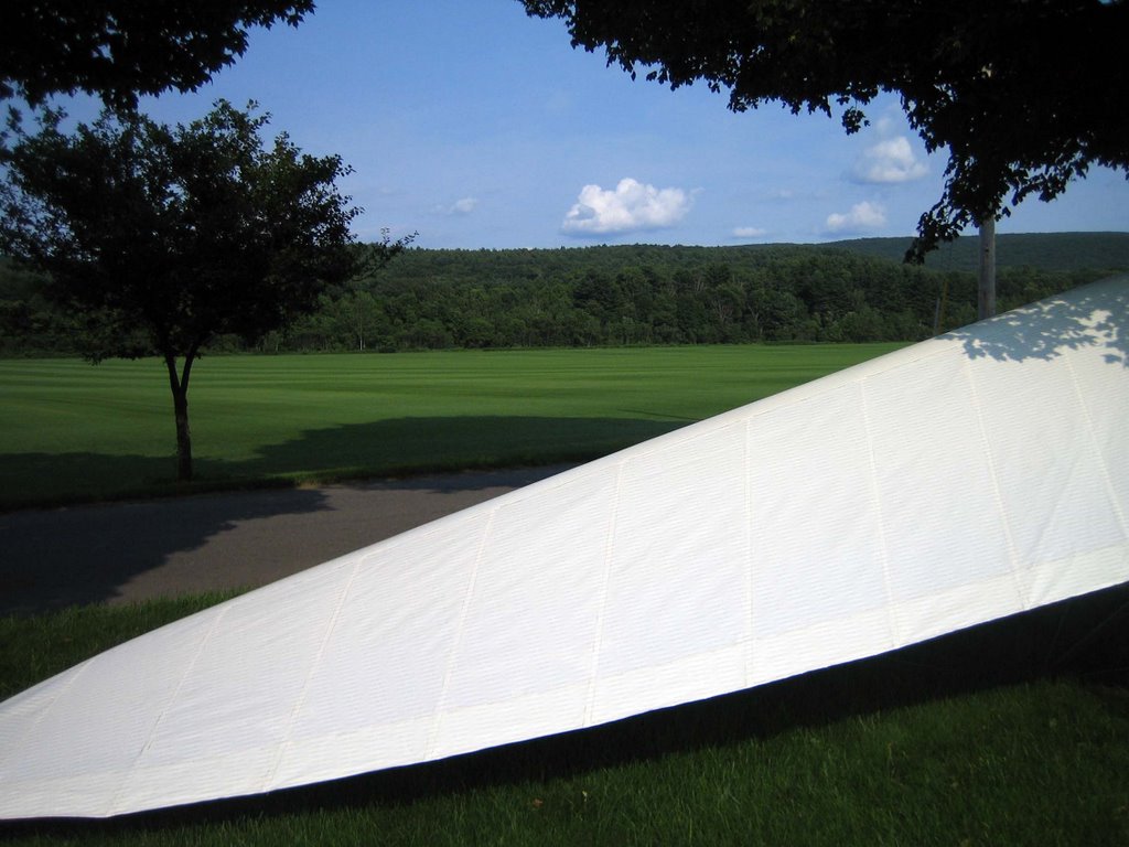
 I flew over Brattleboro and played with some crows over the fields south of there. As I flew further south high cirrus began moving in and the climbs got weaker. I floated down the river slowly climbing as I approached the jump over Turners Falls, Massachusetts. On the way there I noticed one of my favorite landing areas below; a large sod farm with fields so large you could land a Cessna. I could go on a long glide over trees to the Turners Falls airfield or turn back and land on the perfect hang gliding LZ. Um. Easy choice!
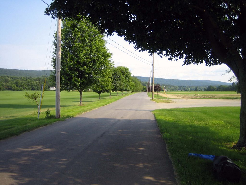
I did some sightseeing while I cashed in my altitude and set up a long lazy aircraft approach along the tree-lined road and had a perfect no-step landing on the inch-high grass a wing span away from the road. I casually walked across the road to a shade tree in a yard so I wasn’t breaking down on the “cash crop”. I turned on my cell phone and almost immediately Rodger called to tell me our new-found drivers just passed him on the ground in Brattleboro. Before I could listen to a voice mail with their telephone number, they called me. What great timing! I explained where Rodger was and gave them my coordinates. They showed up minutes after I finished packing. Again, great timing! There was only one little hitch; one of our drivers wanted to test fly a glider at Morningside earlier in the day but was waiting for the wind to calm down and switch to the west when Judy asked him if he wanted to pick up some pilots. He didn’t think he would be gone so long, how far away could they be? ;-) We rushed back to Morningside and got him to launch in time to beat the catabatic winds. He had a good strong launch into nearly calm conditions and landed near the bulls-eye.
 The flight is available online, but will not be scored since it has a bogus point in the track file.
 This was a fun 56 mile flight across three states. However I was happier to see that Rodger broke out of his recent slump with style. Everyone goes through dry spells if you fly long enough. The “sled king” is dead!
3 comments:
Tom, that photo of the glider and sod field is so perfect that i literally tought it was some kind of animation picture. That is crazy- rivals your "little" Australian LZ field. Where is that dam? Idon't recognize it. I wondered if it was Bratt until you said dam..... PK
It is a picture of Bellows Falls from the New Hampshire side. The dam is above the rocks. You can see the canal coming from the dam that feeds the hydro power station.
P.S. Click on the picture for a larger version.
Post a Comment